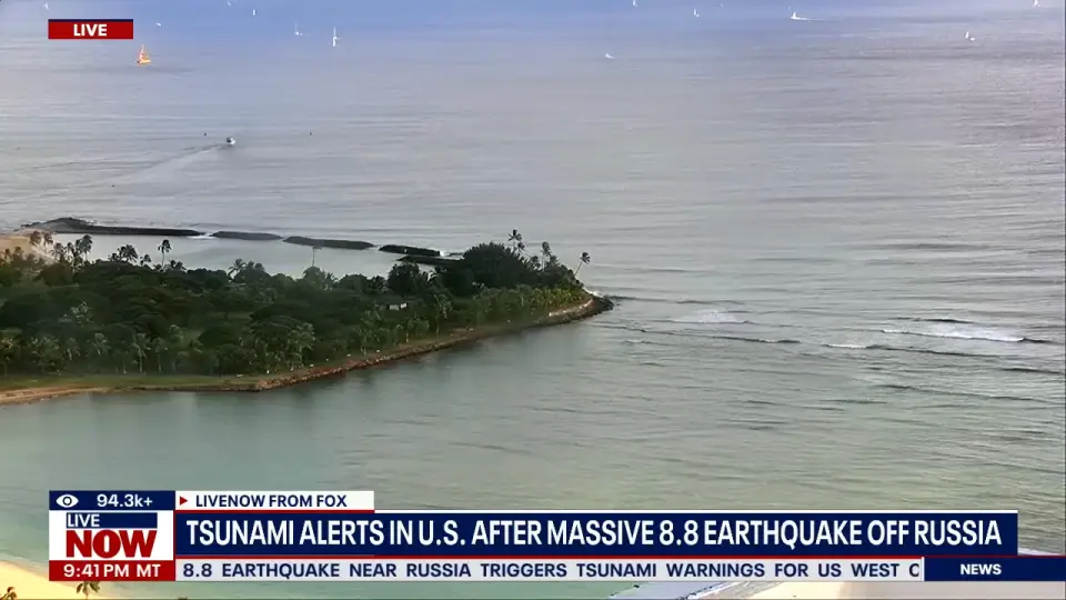
A colossal 8.8 magnitude earthquake off the coast of Russia has sent the Pacific into high alert. This isn’t just a big quake; it’s now tied for the sixth strongest ever recorded. As a result, urgent tsunami warnings and advisories are in effect for Hawaii and the entire U.S. West Coast.
Table of Contents
- 1.1 🚨 What Happened and Why Is This Quake So Significant?
- 1.2 🗺️ Which U.S. Areas Are Under a Warning or Advisory?
- 1.3 ⏰ When Are the Tsunami Waves Expected to Hit?
- 1.4 🌊 How High Will the Waves Be?
- 1.5 📡 How Do Scientists Predict a Tsunami From So Far Away?
- 1.6 📢 What Are Officials Telling People to Do?
Here is what you need to know right now.
🚨 What Happened and Why Is This Quake So Significant?
The earthquake struck about 8 miles off Russia’s east coast. It was first measured at a magnitude of 8.0, but was quickly upgraded to 8.7 and then a final measurement of 8.8. That small decimal jump represents about one and a half times more energy being released.
This event is extremely rare and powerful. The quake originated in a highly active tectonic area known as the “Aleutian Megathrust.” To find a comparable event in this region, experts are looking back nearly 75 years to a major quake in 1952.
🗺️ Which U.S. Areas Are Under a Warning or Advisory?
It is crucial to know the alert level for your specific area.
- TSUNAMI WARNING (Highest Alert): This is in effect for Hawaii, the Alaska Peninsula, and a specific part of Northern California, including Crescent City. People in these zones are being urged to evacuate to higher ground immediately.
- TSUNAMI ADVISORY: This is in effect for the rest of the U.S. West Coast, including Oregon, Washington, and most of California. While less severe, this still poses a danger to those near the water.
⏰ When Are the Tsunami Waves Expected to Hit?
Here are the estimated arrival times for the first waves:
- Hawaii: Around 7:10 PM local time.
- Pacific Northwest (Washington/Oregon): Around 11:40 PM local time.
- Northern California: Around 12:40 AM local time.
- Southern California: Around 1:00 AM local time.
🌊 How High Will the Waves Be?
Wave heights will vary significantly based on your location.
- In the Tsunami Warning zone of Northern California, waves are expected to be 3 to 5 feet above the normal tide. The shape of bays in this area can funnel and amplify the wave’s energy.
- In the Tsunami Advisory zones along the rest of the coast, waves are expected to be about 1 foot above the tide.
📡 How Do Scientists Predict a Tsunami From So Far Away?
You might wonder how we can know this is coming from thousands of miles away. The answer lies with a network of data buoys across the Pacific Ocean.
When the earthquake happened, it displaced a massive column of water 46 miles deep. Much of this energy travels below the surface, so you won’t see a giant wave approaching from the horizon. The buoys detect this underwater surge as it passes, giving us critical data on the tsunami’s speed and power long before it reaches the coast.
📢 What Are Officials Telling People to Do?
Authorities are taking this threat very seriously.
- In Hawaii, Governor Josh Green has signed an emergency proclamation. Sirens are sounding across the islands, and residents are being told to get to higher ground or at least four stories high in a sturdy building.
- The Governor issued a dire warning: “If you do that in Hawaii and you get caught in the wave, you will die.”
- Massive traffic jams have been reported as people evacuate, and airports like Hilo have suspended operations to prepare for emergency response.
If you are on the coast, please listen to your local officials and stay informed.
- South Park Episode Under Fire After Assassination of Charlie Kirk
- Emmys 2025 Recap: ‘The Pitt’ and ‘The Studio’ Win Big as Newcomers
- Mike Tyson Kicks Mr. Beast at Charity Gala: Eyewitnesses Detail Shocking Altercation
- The Complete Winners List for the 77th Emmy Awards (2025)
- ‘The Pitt’ and ‘Severance’ Dominate a Night of Thrilling Upsets at the 77th Emmy Awards
- NFL Week 2 Live: Joe Burrow Injured, Cowboys Rally Against Giants in Hectic Early Slate
- Seattle Seahawks vs. Pittsburgh Steelers: Week 2 Game Day Preview